Professional Forest Maps Numerical browser for Android.
mLas mini is an application that allows you to obtain a lot of information about the forest and the surrounding space.
It is used to display maps from various sources: Geoportal.gov.pl, UMP-pcPL, as well as data owned by the State Forests. To display the layers of the Forest Numerical Map, you need numerical data obtained from a specific Forest District.
The mLas mini application is intended for work in the field - we recommend it in particular to foresters, as well as to all people who need to obtain information about forests: surveyors, farmers, ecologists.
The author of the application (Taxus IT) supports various IT projects related to broadly understood environmental protection - especially GIS in forestry, field work with GPS / GLONASS. mLas mini is a product similar to the mLas Inżynier application, which is commonly used by foresters in Poland.
Application functionality:
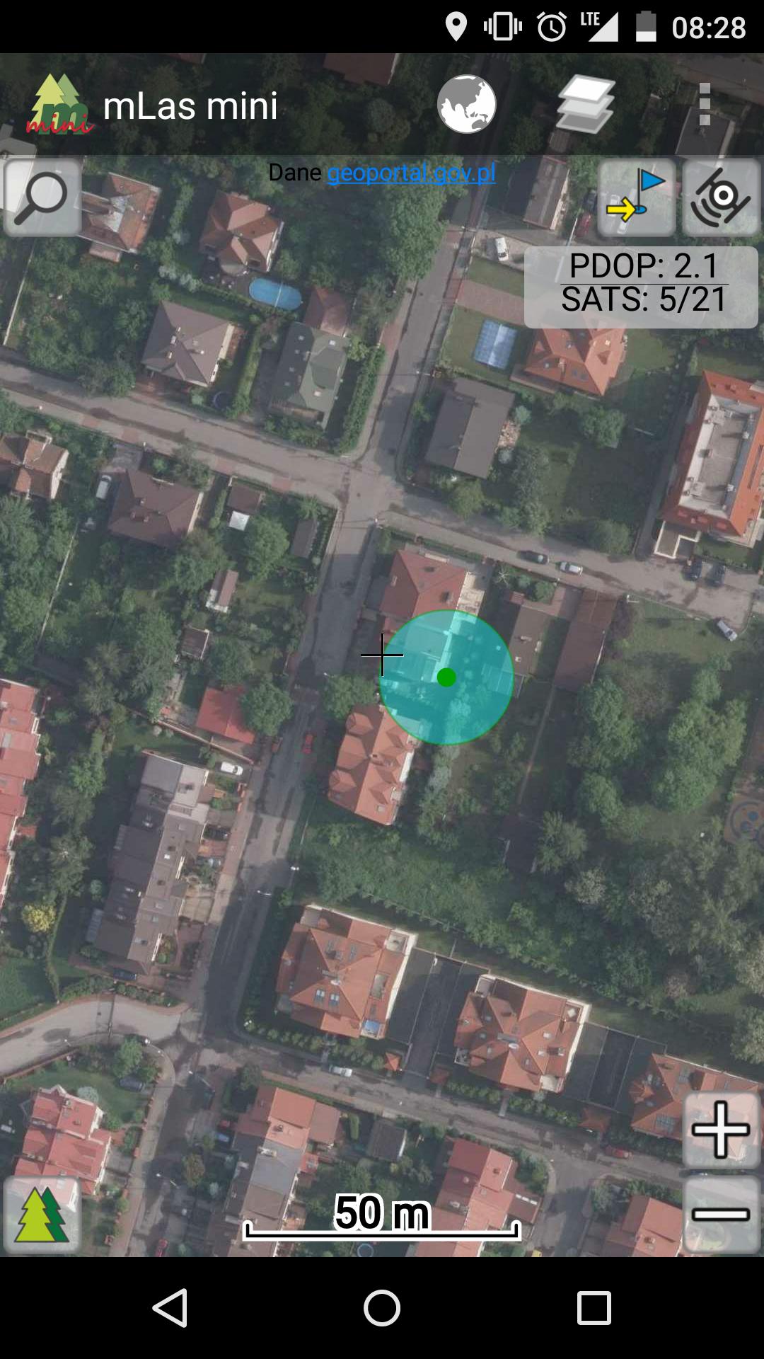
- displaying aerial and satellite photos (orthophoto map),
- displaying a topographic map,
- displaying the UMP-pcPL map - detailed map and digital terrain model
- displaying an economic map,
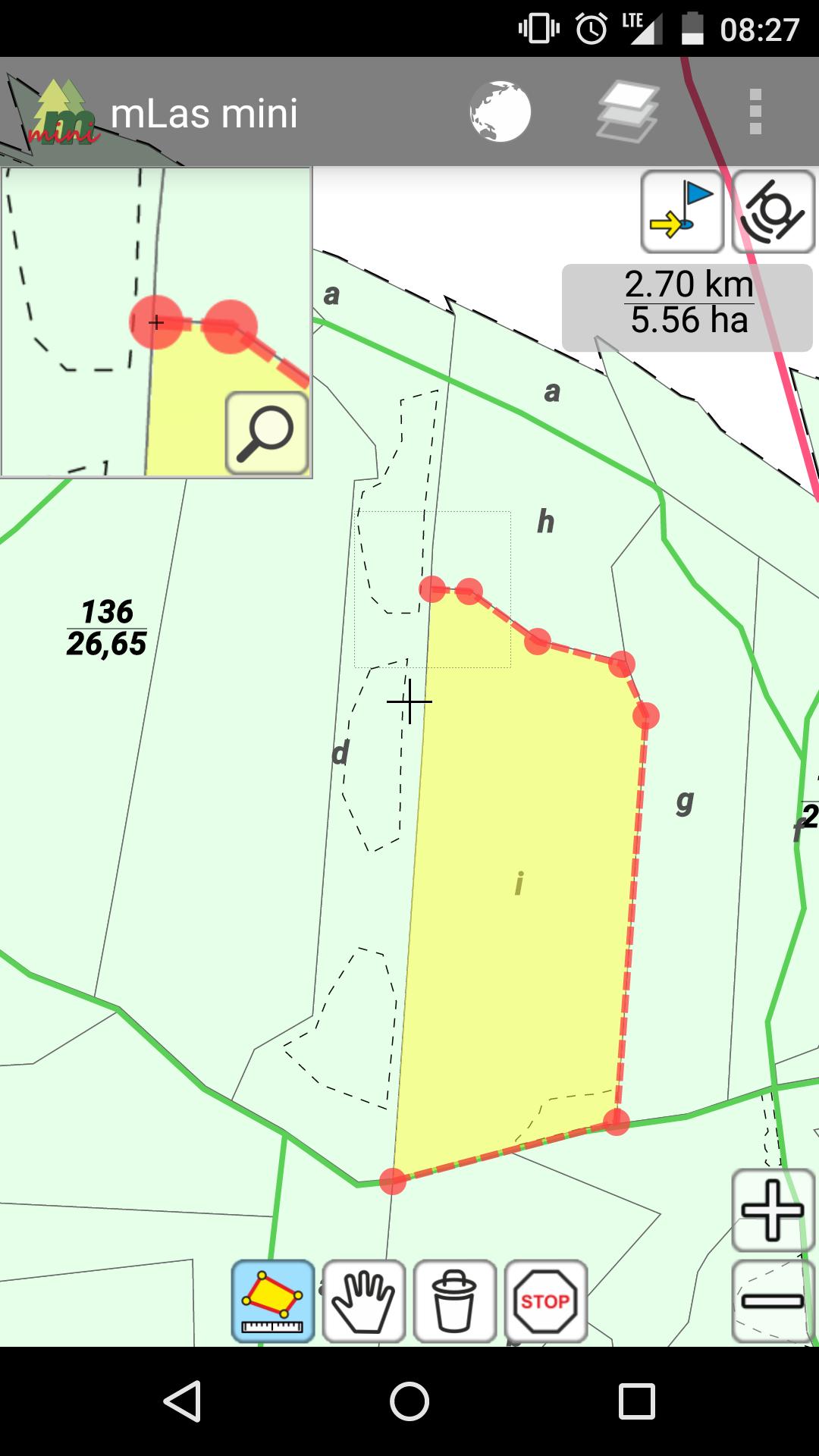
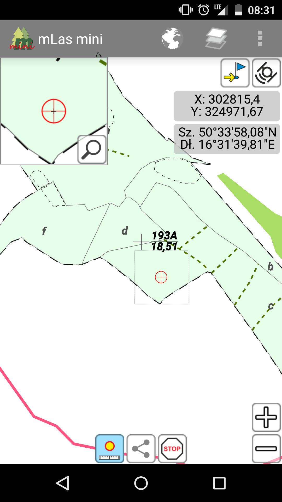
- displaying data from the Forest Numerical Map (LMN) of the State Forests,
- distance and area measurements,
- searching for objects by forest address
- displaying assessment description (habitat and tree stand),
- GPS location – display and track position
- measurement of point coordinates with the possibility of sharing data
- adding destinations with the option of sharing (GoTo function)
- maps displayed from the WMTS service
- button size adapted to tablets
Minimum requirements:
- Android 4.0.3 (ICE CREAM SANDWICH)
- built-in disk memory or memory card
- screen diagonal: 4.0"
- screen resolution: 480x800
GPS location:
- built-in GPS receivers,
- external GPS receivers via Bluetooth.
The application uses map data provided by external services:
- Map Geoportal.gov.pl - http://www.geoportal.gov.pl
- UMP-pcPL map - http://ump.waw.pl
- Digital terrain model - http://srtm.csi.cgiar.org
Read more